Home
Shopping portal
Fund raising
- Fund raising events
- Extension plans
The Church
Community
Donate now
Be a whizz
Fun & family stuff
Questions on this site
Mailing list
Press


bookmark this page


offa's bikers - day 2

Offa's Bikers pages: home, route overview, stats summary, day1, day2, day3


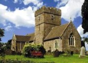
Day 2 was Friday 28th July. We left Chirk at 8:35 am and headed up hill (inevitably!) to Selattyn (see the primary school's website - its says nothing about being at the top of a very steep hill!) arriving 9:10am. Lunch was @ 12:05 - 12:50 (at the top of yet another hill) having done just under 36 miles and having been peddling for over 3 hours. Its was very hot with the tarmac melting on the roads and it was a very tough day. After a rest in Knighton (we had aimed for afternoon tea but arrived just after 5:00pm), we arrived at the Harp Inn in Old Rock at around 7:20pm. The Harp Inn is lovely, old, sells great beer and has great views. Unfortunately great views = height and, yes you guessed it, it is at the top of a very steep hill! 78 miles cycled in Day 2 in a total cycling time of 8 hours 21 minutes! Ouch!


Click on the thumbnail to see a bigger photo.


118_1868_750.JPG

118_1869_750.JPG

118_1870_750.JPG

118_1871_750.JPG

Selattyn - at the top

Above Oswestry

Above Oswestry

Above Oswestry

118_1872_750.JPG

118_1873_750.JPG

118_1874_750.JPG

118_1875_750.JPG

Above Oswestry

Offa's Business Park @ Buttington

Montgomery Castle in the distance

Montgomery Castle a bit closer

118_1876_750.jpg

118_1877_750.jpg

118_1878_750.JPG

118_1879_750.jpg

Entering Montgomery

Lunch in Montgomery

Montgomery town centre

The only way is up!

118_1880_750.JPG

118_1881_750.JPG

118_1882_750.JPG

118_1883_750.JPG

Nice views

but it's a pain

getting there!

Somewhere en route

118_1884_750.JPG

118_1885_750.JPG

118_1886_750.jpg

118_1887_750.JPG

Views

Views

See note below!

Views

118_1888_750.jpg

118_1889_750.JPG

118_1890_750.jpg

118_1891_750.jpg

Offa's Dyke path

A poor bit of the dyke with Newcastle Church (Newcastle in the Clun Forest) in the Background.

This was the start of the toughest hill on the route. A near vertical climb up above Newcastle!

That's how we got to the start of the climb!

118_1892_750.JPG

118_1893_750.JPG

118_1894_750.JPG

118_1895_750.JPG

Above Newcastle

Above Newcastle

Above Newcastle

Newcastle Church from on high!

118_1896_750.JPG

118_1897_750.JPG

118_1898_750.JPG

118_1899_750.JPG

Close up of the dyke

Close up of the dyke

View from the dyke

Close up of the dyke

118_1900_750.JPG

119_1901_750.JPG

119_1902_750.JPG

119_1903_750.JPG

Close up of the dyke

Close up of the dyke

The Dyke in the distance

Knighton

119_1904_750.JPG

119_1905_750.JPG

119_1906_750.JPG


Knighton

Knighton

The Harp Inn, Old Radnor


Note: It was always a relief to see Mark and Kevin as it meant I was getting to the top of the hill finally!


Copyright 2003-2006 by David Cornwell and other contributors. All Rights Reserved. Site design: nrgsmith
All views represent the opinion of the authors and the information contained in this website is provided purely for information purposes and is provided 'as is' without warranty either expressed or implied.

Comments, suggestions, etc. Contact webmaster.

Please click here to read full disclaimer and conditions of use